Compass: Engine™ is a decision intelligence software-as-a-service solution.
By automatically linking and contextualising data and integrating models and simulations at scale in the cloud it unleashes the power of advanced data science, AI/ML and digital twins to deliver holistic place-based insights up to 80% faster.

Compass: Engine™ uses a unique implementation of graph-technology developed from over a decade of research and development. This enables:
Compass: Engine™ is prepopulated with the regional data sets you need, including:
Easily import and export your own custom data sets and seamlessly integrate with Esri geospatial files.
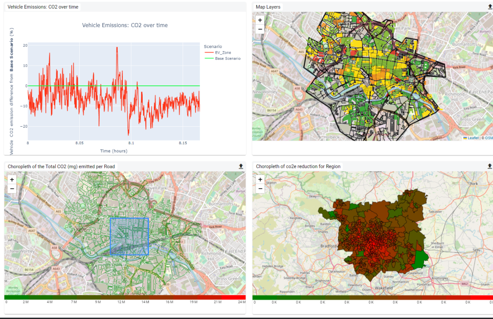
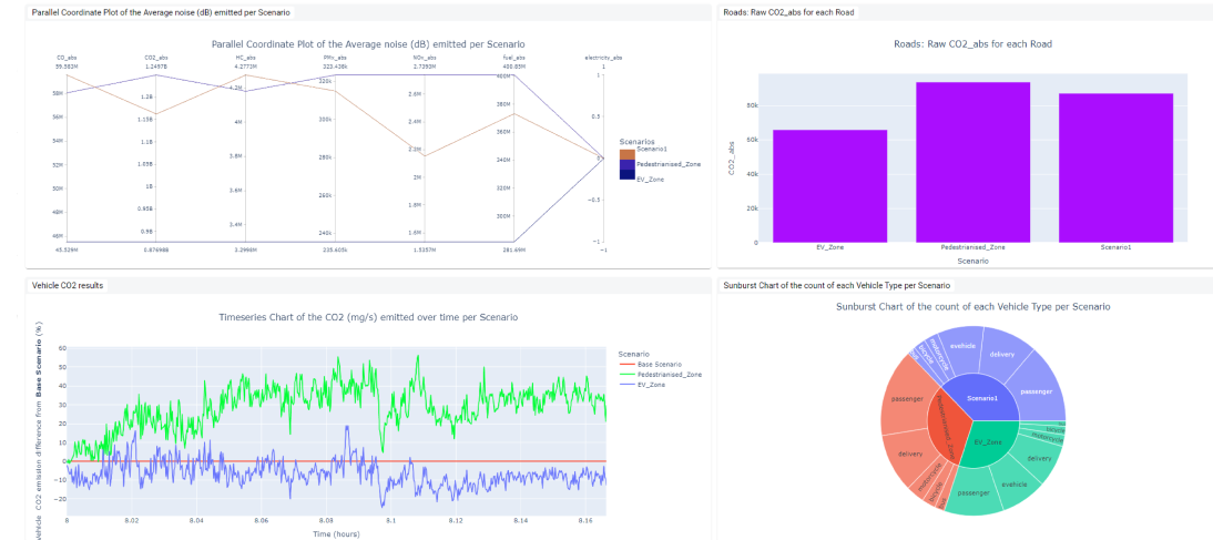
Test, optimise and strategise intervention scenarios with Compass: Engine™’s in-built model and simulation capabilities. Access carbon conversion factors for hundreds of policy intervention options, test different fleet mix and modality scenarios on emissions and noise output per road with mobility and traffic simulations and examine the impact of extreme climate events with environmental simulations.
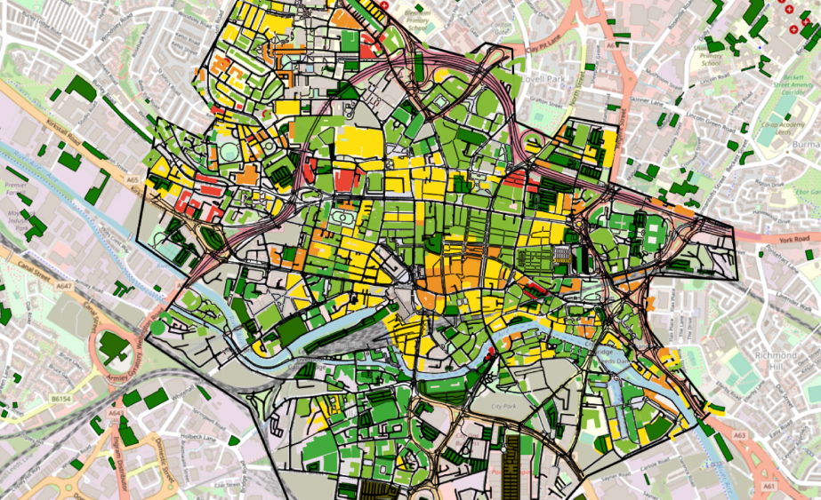
View intervention zone specifications directly on a map for LEZ, pedestrianisation, flood zones and more. For specific insights, you can configure unique models and simulations.
Configure multiple scenarios and compare the relative impact of each intervention on a region. Engage key stakeholders with core findings in charts, graphs and maps and export data for continued analysis.
Build bespoke charts and graphs in a customisable, dynamic interface.
Compass: Engine™ is prepopulated with hundreds of place-based data sets to inform policy decision making. These span geospatial, energy, building and land use, mobility, environmental and economic data. The product is flexible to accommodate a user’s own data and offers direct integration with Esri.
Compass: Engine™ connects traditionally siloed modelling and simulations to deliver an holistic, system level perspective on “what-if” policy interventions. These include carbon conversion factors, flooding and mobility simulators. Easily predict the directional impact of resident behaviour changes, climate events and mobility interventions such as low emissions zones, low traffic neighbourhoods, road closures and pedestrianisation. User specific models and simulations can also be configured in the product.
Using advanced data science and the power of cloud computing, users can rapidly explore the impact of policy intervention combinations at massive scale, quickly converging on a short list for more detailed exploration and consultation. A wide range of data and graphical output options facilitate communication with different stakeholders, making the complex understandable.
If you’d like to know more about Compass: Engine™ , contact our team and we will be in touch shortly.
Copyright © 2005–2024 | Slingshot Simulations Ltd Website by Trio Media | Registered Address: Nexus, Discovery Way, Leeds, LS2 3AA | Company Number: 11996161 | VAT Number: 331219243